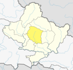
Madi Rural Municipality, Kaski
Madi Rural Municipality
मादी गाउँपालिका | |
|---|---|
| Coordinates: 28°15′21″N 84°06′04″E / 28.255711°N 84.101028°E | |
| Country | |
| Province | Gandaki |
| District | Kaski District |
| Area | |
| • Total | 563 km2 (217 sq mi) |
| Population | |
| • Total | 18,153 |
| • Density | 32/km2 (84/sq mi) |
| Time zone | UTC+5:45 (Nepal Time) |
| Website | http://madimunkaski.gov.np/ |
Madi Rural Municipality (Nepali : मादी गाउँपालिका) is a Gaunpalika in Kaski District in Gandaki Province of Nepal. On 12 March 2017, the government of Nepal implemented a new local administrative structure, with the implementation of the new local administrative structure, VDSs have been replaced with municipal and Village Councils. Madi is one of these 753 local units.[1]
Demographics
[edit]At the time of the 2011 Nepal census, Madi Rural Municipality had a population of 18,153. Of these, 65.2% spoke Nepali, 31.6% Gurung, 1.6% Tamang, 0.9% Magar, 0.3% Bhujel, 0.1% Yolmo, 0.1% Newar, 0.1% Urdu and 0.2% other languages as their first language.[2]
In terms of ethnicity/caste, 32.8% were Gurung, 24.6% Hill Brahmin, 11.5% Kami, 11.1% Chhetri, 7.1% Damai/Dholi, 5.1% Sarki, 1.8% Magar, 1.7% Tamang, 1.4% Gharti/Bhujel, 1.2% Thakuri, 0.6% Sanyasi/Dasnami, 0.5% Badi, 0.2% Newar, 0.1% Yolmo, 0.1% Musalman, 0.1% other Terai and 0.2% others.[3]
In terms of religion, 73.7% were Hindu, 21.1% Buddhist, 0.7% Christian, 0.6% Bon, 0.1% Muslim and 3.8% others.[4]
In terms of literacy, 67.0% could both read and write, 2.7% could only read and 30.2% could neither read nor write.[5]
References
[edit]- ^ "मादी गाउँपालिका : कास्की जि.स.स". ddckaski.gov.np. Retrieved 2020-07-05.
- ^ NepalMap Language
- ^ NepalMap Caste
- ^ NepalMap Religion
- ^ NepalMap Literacy


